

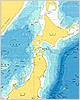
Nautical Charts / Reference Charts
Nautical Charts, Electronic Navigational Charts (ENC), Yachting Charts (Y Chart),
Small Port Guides (S Guide),
New Electronic Reference Charts
(new pec).
Bathymetric Charts
These maps include Basic Maps of the Sea in Continental Shelf Areas, Basic Maps of the Sea in Coastal Waters, Ocean Sounding Charts, etc.
Miscellaneous Charts
Miscellaneous Charts show supplementary data and information to nautical charts and are used for referencial purpose of navigation. When used together with nautical charts, they will serve for more effective operation and maneuvering of vessels.
Aeronautical Charts
Showing established aeronautical routes, aviation facilities, aeronautical landmarks and various items necessary for air navigation. 1/1,000,000 scale international aeronautical Charts, 1/1,000,000 scale and 1/500,000 scale domestic aeronautical charts are published.
Sailing Directions

Book describing detailed information on various maritime and related conditions such as weather at sea, passages and fairways, ports and harbors and coastal waters, etc. to supplement the contents of nautical charts. It is to be used in parallel with nautical charts.
Special Publications

These are Nautical Publications other than Sailing Directions. Some of them are used together with nautical charts, and some others are used independently.