


FOR PLEASURE BOATS
- FOR ANGLING
- FOR VESSELS IN GENERAL
- FOR BEACH PLEASURE
- EDUCATION AND HOBBY
Nautical Chart
It is the obligation for mariners to keep nautical charts published by JHOD/JCG on board while navigating. However, MLIT designated so-called semi-nautical charts to be used conveniently in small space of pleasure boats and to give sufficient information to small craft for small harbors to supplement ordinary nautical charts.
Small Port Guide
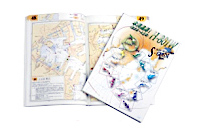
Gives useful information for entering ports and harbors, large and small, all over Japan. Although compact in size, it contains full of detailed information on small harbors. Semi-nautical charts designated by MLIT for small craft use in coastal waters.(Japanese text only)
Yachting Chart
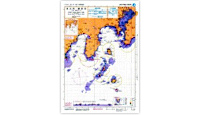
Chart in handy size. Usable even if it gets wet. Semi-nautical charts designated by MLIT for small craft use in coastal waters.(Japanese text only)
Nautical chart
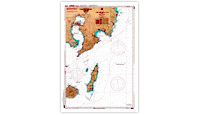
If there is no appropriate simple product, a nautical chart should be used instead since nautical charts cover all over Japanese coasts.
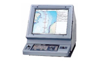
Electronic Chart
Can be used on a notebook PC, and operative with GPS. Simpler and more convenient than paper charts.
new pec(Electronic Reference Chart)
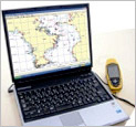
Packed with software and can be used immediately after installation. High cost-performance. Can be connected with GPS for easy use in sea navigation.
ENC(Electronic Navigational Chart)
Become widely used on merchant vessels. Available nationwide. An exclusive display software or devise (ECDIS) is necessary.
Sailing Directions - Guidebook of the Sea
Sailing Directions
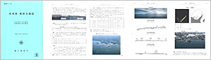
Guidebook of the sea fully containing information necessary for navigation along coasts as well as entry into and departure from ports and harbors.
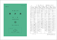
Tides and Tidal Currents
Depths of water change according to rise and fall of tide, which affects ship’s navigation in shallow water area and mooring. Predicted values of tides and tidal currents for one year are compiled into these tables.
Tide Tables
Coastal Tide Table (Seto Naikai, Kyushu, Nansei Shoto)
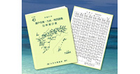
Digest edition of Tide Tables for local use.
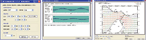
New on sale. This enables to find ETA at destination by calculating tidal currents affected en route based on optional shipping route and departure time. The flowing condition of tidal currents en route can be seen by arrows on the drawing.
Seto Naikai Navigation Software
Tidal Current Chart
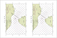
Usual paper tidal current charts are also available.