


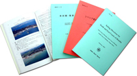
This is a book describing detailed information on various maritime and related conditions such as weather at sea, passages and fairways, ports and harbors and coastal waters, etc. to supplement the contents of nautical charts.? It is to be used in parallel with nautical charts.
For Sailing Directions, there are "Sailing Directions for Domestic Waters" containing descriptions covering the Japanese waters and adjacent seas and "Sailing Directions for Foreign Waters covering the Coast of Korea to the Malacca Strait and adjacent waters of Indonesia.
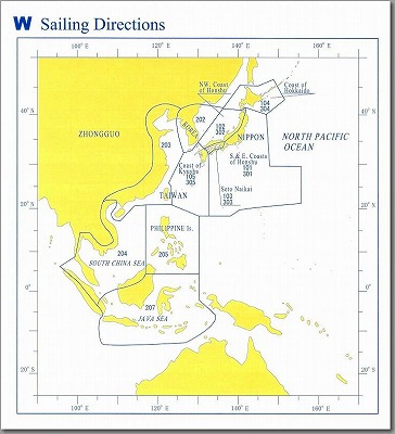
List of Sailing Directions
Sailing Directions for Domestic Waters
Compiled on the basis of data and information collected from the surveys, observations and investigations carried out by the Japan Coast Guard as well as from other sources.? This publication is to be revised every 5 years.? In order to keep its contents up-to-date, a Supplement is to be issued every year.
There are a Japanese version and an English version of this publication.
| Pub. No. | Title | |
|---|---|---|
| Japanese Version | 101 | S. & E. Coasts of Honshu Pilot |
| 102 | NW Coast of Honshu Pilot | |
| 103 | Seto Naikai Pilot | |
| 104 | Coast of Hokkaido Pilot | |
| 105 | Coast of Kyushu Pilot | |
| English Version | 301 | Sailing Directions for South & East Coasts of Honshu |
| 302 | Sailing Directions for Northwest Coast of Honshu | |
| 303 | Sailing Directions for Seto Naikai | |
| 304 | Sailing Directions for Coast of Hokkaido | |
| 305 | Sailing Directions for Coast of Kyushu |
Sailing Directions for Foreign Waters
They are covering the seas extending from the Coast of Korea to the Malacca Strait and adjacent waters of Indonesia, compiled from Admiralty and U.S. Pilots as well as from those of sovereign countries concerned, with additional data and information.
| Pub. No. | Title |
|---|---|
| 202 | Coast of Korea Pilot |
| 203 | Coasts of China and Taiwan Pilot |
| 204 | South China Sea and Malacca Strait Pilot |
| 205 | Philippine Is. Pilot |
| 207 | Jawa Sea Pilot |
Note: Japanese version only.