


Bathymetric Chart
Basic Map of the Sea in Coastal Waters
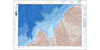
Reefs where fish cluster can be located on the Bathymetric Chart. The depth contour intervals are closer than those on nautical charts so that detailed bottom configuration can be seen.
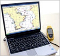
Electronic bathymetric chart. Accompanying software enables to freely zoom up, zoom in and print out images. If a compatible navigational software on the market is used, such CP functions as plotting of track, point information, duplicate display over ENC, etc. are also available.
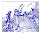
Digital Bathymetric Data
Nautical Chart
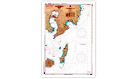
Since a nautical chart is for general use in navigation, it is not specialized in submarine topographic information, but names and positions of shoals, fishing reefs, etc. are shown.
FOR RECORDING ANGLING RESULTS
new pec(Electronic Reference Chart)
Recording of angling points is a convenient function for an angler. When clicking the point afterwards, the scenery or picture of fish angled which you registered will be displayed.
TO LEARN EBB AND FLOW OF TIDES
The result of angling largely depends on the range of tides and ebb and flow. Tidal and tidal current predictions are available for one year all over Japan.
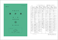
Tide Tables
Coastal Tide Table (Seto Naikai, Kyushu, Nansei Shoto)
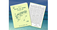
Digest edition of Tide Tables for local use.